Carte des côtes d’Espagne
La Costa Blanca est la côte est autour d’Alicante. La Costa del Sol est la côte sud autour de Málaga. En zoomant, les repères passent de la côte aux villes, au nombre de logements et aux sorties.
Comparer les côtes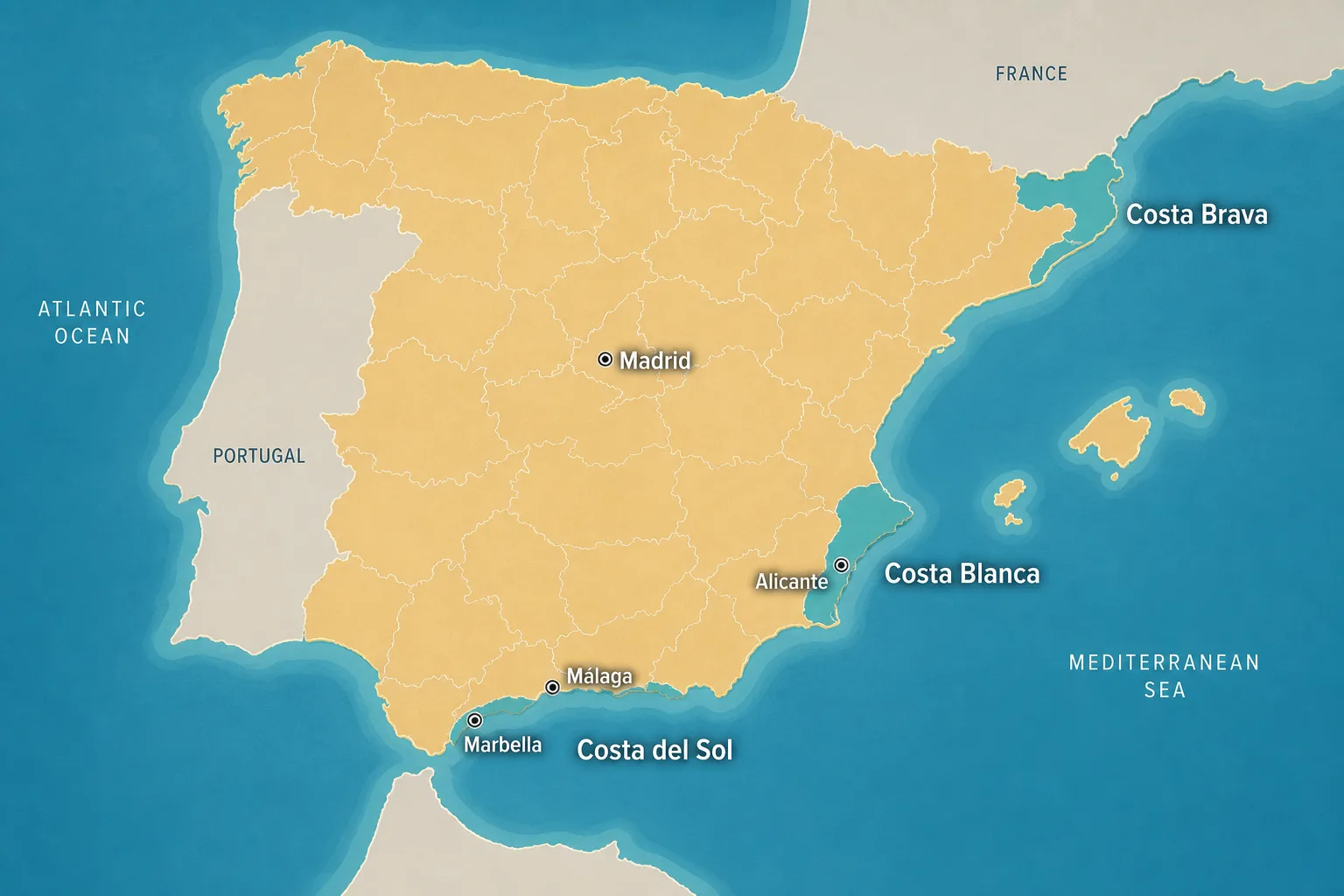
Spain map
Carte interactive de l’Espagne avec villes et côtes. Costa Blanca, Costa del Sol, logements à vendre et idées de sorties.
Hover a province on desktop, then zoom in. Coastal pins and area markers show homes for sale, and things-to-do pins appear as you get closer to a town.
Start with the coasts. Zoom in for town markers with a property count, then for beaches, golf and other things to do.
La même carte couvre les deux côtes. Utilisez-la comme carte de la Costa Blanca ou de la Costa del Sol, puis ouvrez les logements.
La Costa Blanca est la côte est autour d’Alicante. La Costa del Sol est la côte sud autour de Málaga. En zoomant, les repères passent de la côte aux villes, au nombre de logements et aux sorties.
Comparer les côtesDe Torrevieja et Orihuela vers le nord, par Alicante, Benidorm, Altea, Calpe, Jávea et Dénia.
Logements sur la Costa BlancaLe long de la province de Málaga, de Málaga et Fuengirola à Benalmádena, Marbella et Estepona.
Logements sur la Costa del SolThese are the coastal cities and towns buyers compare first. Open a town for homes, or stay on the lifestyle side with things to do.
Buyers usually move from coast or region, to a municipality (town), then to a district or neighbourhood when comparing homes.
Broad markets such as Costa Blanca and Costa del Sol group many towns under a lifestyle and climate identity buyers recognise.
Administrative provinces (for example Alicante or Málaga) help compare prices, airports and services across neighbouring towns.
Town-level areas such as Marbella, Torrevieja or Alicante are usually the best place to start a concrete property search.
Within a municipality, districts and urbanisations refine walkability, beach access, golf communities and local amenities.
These are the markets most international buyers compare first. Each path leads to guides and live listings.
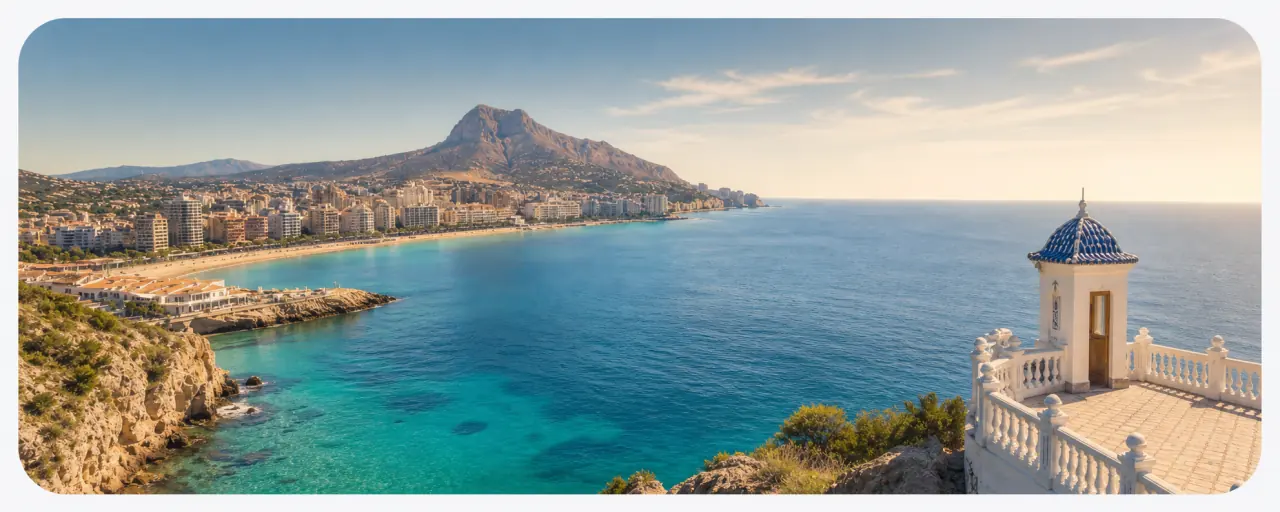
Mediterranean east coast around Alicante — popular for value, sunshine and coastal towns from Torrevieja to Altea.

Southern coast around Málaga — established international demand, golf communities and towns from Fuengirola to Estepona.
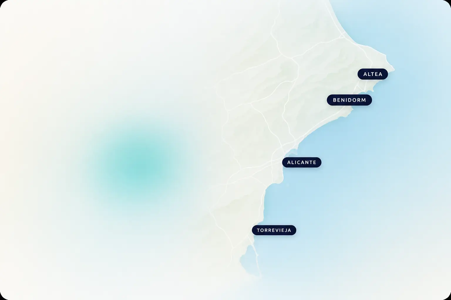
A practical city base with airport access, coastal living and a large international buyer mix.
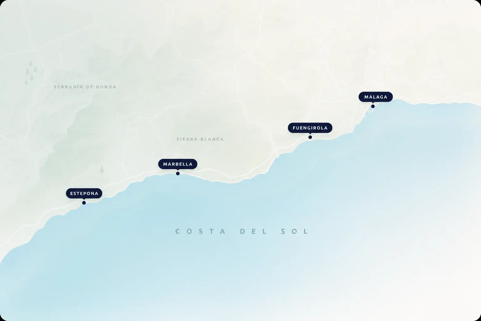
One of Costa del Sol’s best-known municipalities for premium homes, beach lifestyle and year-round services.
Biens à vendre
Carte interactive de l’Espagne avec villes et côtes. Costa Blanca, Costa del Sol, logements à vendre et idées de sorties.
3 794 annonces actives
 4 637 000 €
Spain

 8 795 000 €
Spain
 5 945 000 €
Spain
 5 995 000 €
Spain
 995 000 €
Spain
 28 950 000 €
Spain
 2 975 000 €
Spain
 9 300 000 €
Spain
 2 150 000 €
Spain
 2 995 000 €
Spain
Parcours associés
Move from destination research into coast hubs, town searches and the main Spain property overview.
FAQ
Most international buyers start with Costa Blanca and Costa del Sol because they combine strong property supply, airports and established expat services.
A municipality is the town or city council area (for example Marbella). Districts and neighbourhoods sit inside that municipality and help you compare micro-locations.
Yes. Coastal pins and area markers show how many homes are listed. Click one, or open a city below, to continue into that search.
Yes. Zoom in from the country view and town markers appear with a property count. Closer still, pins mark beaches, golf, restaurants and other things to do in that town.